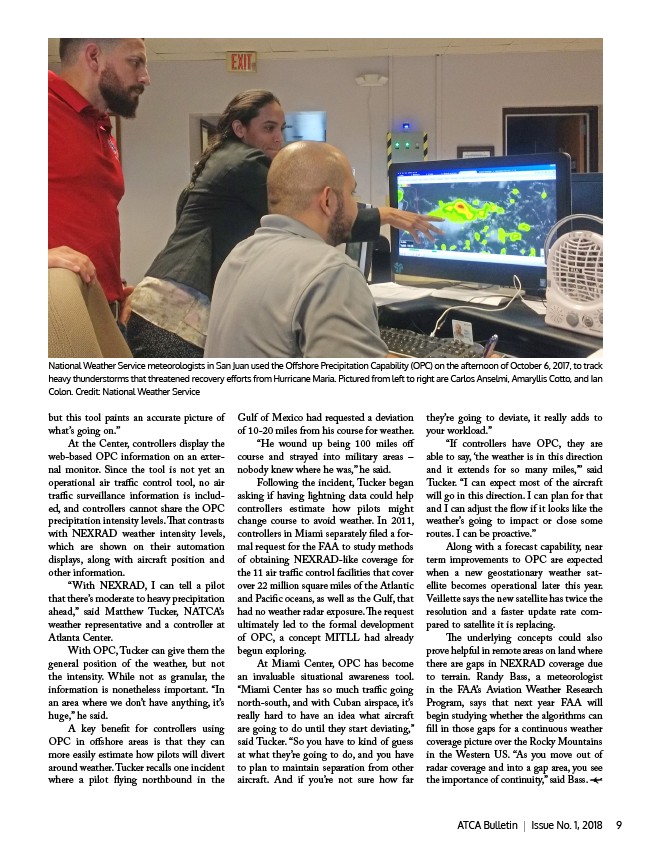
National Weather Service meteorologists in San Juan used the Offshore Precipitation Capability (OPC) on the afternoon of October 6, 2017, to track
heavy thunderstorms that threatened recovery efforts from Hurricane Maria. Pictured from left to right are Carlos Anselmi, Amaryllis Cotto, and Ian
Colon. Credit: National Weather Service
but this tool paints an accurate picture of
what’s going on.”
At the Center, controllers display the
web-based OPC information on an exter-nal
monitor. Since the tool is not yet an
operational air traffic control tool, no air
traffic surveillance information is includ-ed,
and controllers cannot share the OPC
precipitation intensity levels. That contrasts
with NEXRAD weather intensity levels,
which are shown on their automation
displays, along with aircraft position and
other information.
“With NEXRAD, I can tell a pilot
that there’s moderate to heavy precipitation
ahead,” said Matthew Tucker, NATCA’s
weather representative and a controller at
Atlanta Center.
With OPC, Tucker can give them the
general position of the weather, but not
the intensity. While not as granular, the
information is nonetheless important. “In
an area where we don’t have anything, it’s
huge,” he said.
A key benefit for controllers using
OPC in offshore areas is that they can
more easily estimate how pilots will divert
around weather. Tucker recalls one incident
where a pilot flying northbound in the
Gulf of Mexico had requested a deviation
of 10-20 miles from his course for weather.
“He wound up being 100 miles off
course and strayed into military areas –
nobody knew where he was,” he said.
Following the incident, Tucker began
asking if having lightning data could help
controllers estimate how pilots might
change course to avoid weather. In 2011,
controllers in Miami separately filed a for-mal
request for the FAA to study methods
of obtaining NEXRAD-like coverage for
the 11 air traffic control facilities that cover
over 22 million square miles of the Atlantic
and Pacific oceans, as well as the Gulf, that
had no weather radar exposure. The request
ultimately led to the formal development
of OPC, a concept MITLL had already
begun exploring.
At Miami Center, OPC has become
an invaluable situational awareness tool.
“Miami Center has so much traffic going
north-south, and with Cuban airspace, it’s
really hard to have an idea what aircraft
are going to do until they start deviating,”
said Tucker. “So you have to kind of guess
at what they’re going to do, and you have
to plan to maintain separation from other
aircraft. And if you’re not sure how far
they’re going to deviate, it really adds to
your workload.”
“If controllers have OPC, they are
able to say, ‘the weather is in this direction
and it extends for so many miles,’” said
Tucker. “I can expect most of the aircraft
will go in this direction. I can plan for that
and I can adjust the flow if it looks like the
weather’s going to impact or close some
routes. I can be proactive.”
Along with a forecast capability, near
term improvements to OPC are expected
when a new geostationary weather sat-ellite
becomes operational later this year.
Veillette says the new satellite has twice the
resolution and a faster update rate com-pared
to satellite it is replacing.
The underlying concepts could also
prove helpful in remote areas on land where
there are gaps in NEXRAD coverage due
to terrain. Randy Bass, a meteorologist
in the FAA’s Aviation Weather Research
Program, says that next year FAA will
begin studying whether the algorithms can
fill in those gaps for a continuous weather
coverage picture over the Rocky Mountains
in the Western US. “As you move out of
radar coverage and into a gap area, you see
the importance of continuity,” said Bass.
ATCA Bulletin | Issue No. 1, 2018 9